
Stop Waiting
on Stakes.
Start Building.
TerraGenie puts professional-grade positioning directly in the hands of your field teams, enabling fast layout, grade verification, and volume calculations in real time. No downtime. No guesswork. Just accurate results that keep your project moving.
FCC Certified Hardware | US Support Team


How Much is "Waiting for Layout" Costing You?
Every hour your equipment sits idle waiting for re-stakes is lost profit. Every day you wait for third-party layout or verification pushes your schedule—and your margins—in the wrong direction.
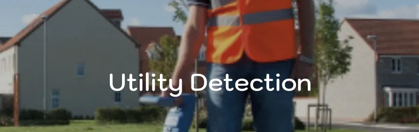
You don’t need a survey degree to check grades or mark offsets.
You need a tool built for construction crews.
TerraGenie bridges the gap between office plans and the jobsite—putting precise layout and verification directly in your foreman’s hands.
Professional Precision. Contractor Independence.
Watch: Restore lost site markings in seconds—without calling a surveyor.
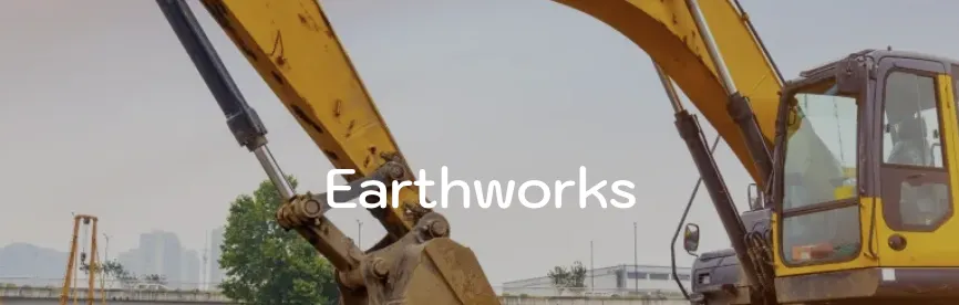
Instant Construction Layout
Stop guessing from faded stakes. Load your CAD plans directly onto a rugged field tablet and see your exact position in real time. Mark offsets, curb lines, and utility runs with Inch-level accuracy—right where the work is happening.
Real-Time Quality Control (QC)
Catch mistakes before they become costly rework. Verify subgrade elevations, check pipe inverts, and confirm column locations instantly against the design. Know you’re right before you pour, not after.
Automated As-Built Verification
Don’t just build—document. Capture as-built data automatically as work progresses. Generate volume calculations, point lists, and verification reports on-site, then sync everything back to the office instantly.
Built for the Job Site. Not the Lab.
TerraGenie is a complete, ruggedized construction-ready system designed to work the moment you open the case. No complex integrations. No IT setup. Just reliable hardware built to perform in real jobsite conditions.
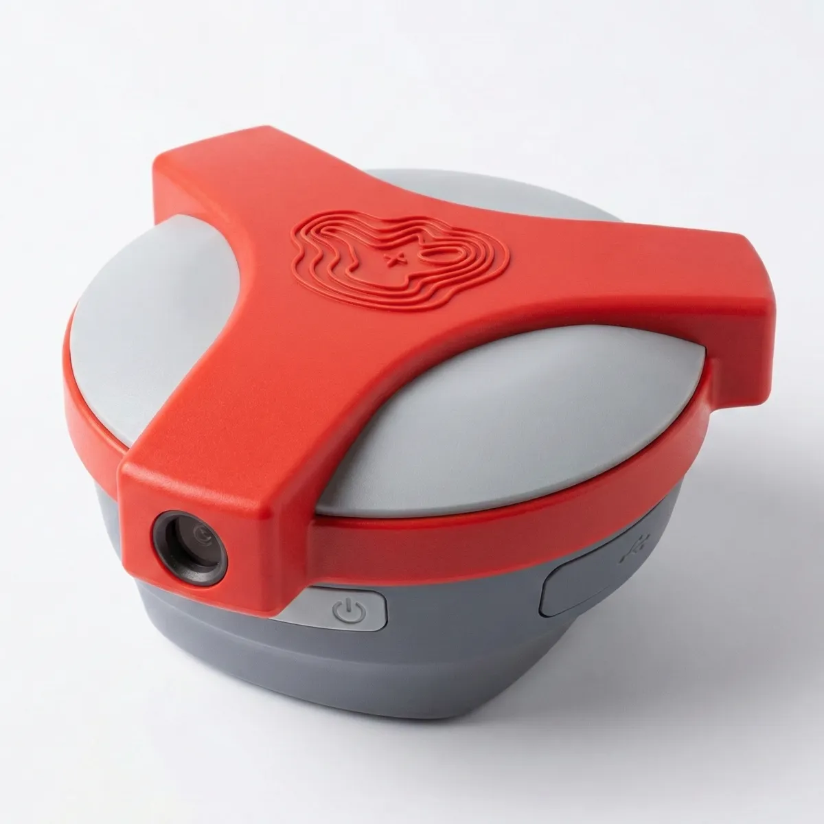
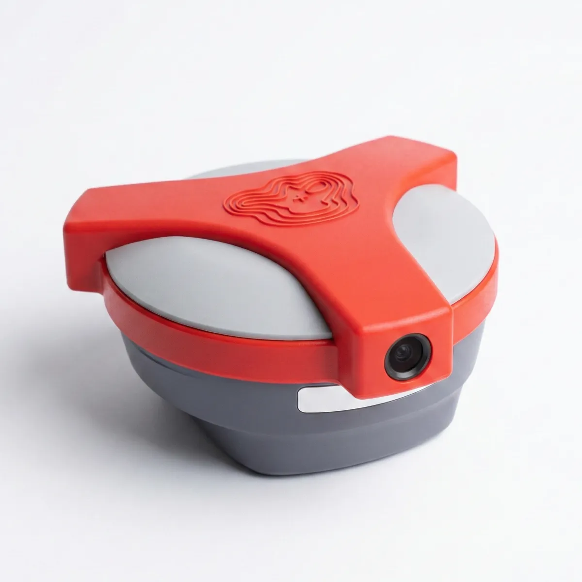
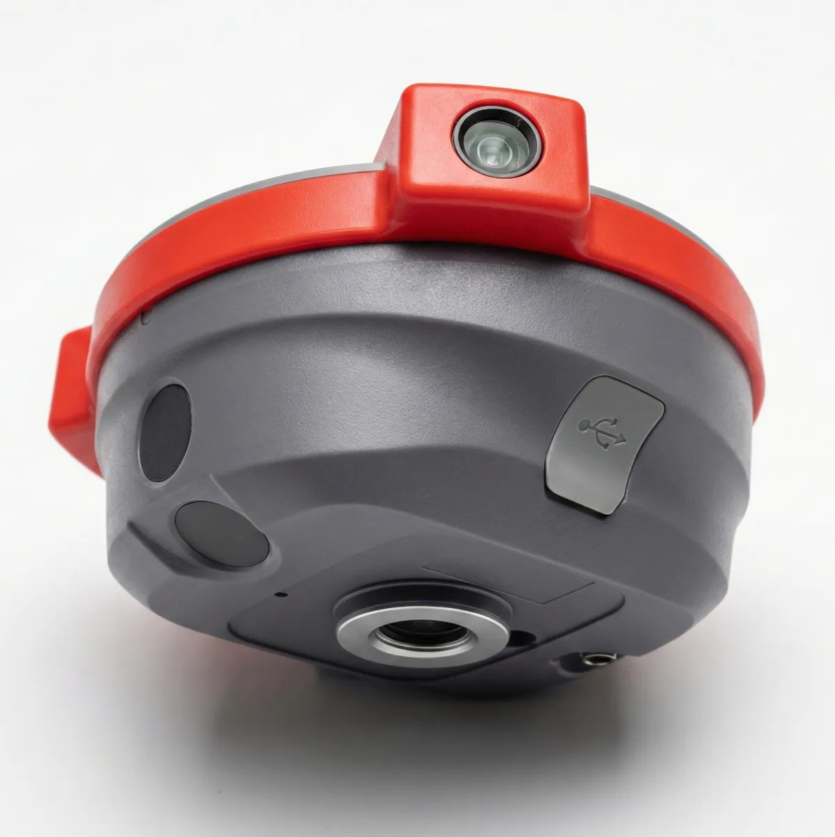
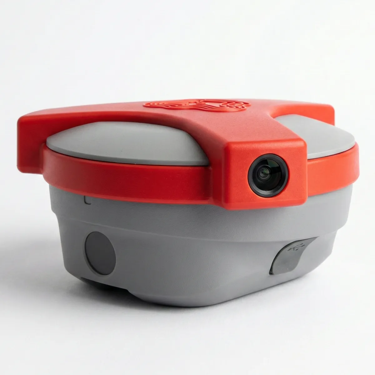
The "Tilt-and-Go" Powerhouse
The TerraGenie G1 features advanced IMU Tilt Compensation. Shoot points at a 60° tilt without leveling the bubble. 1408 Channels lock onto satellites in dense urban canyons or under tree canopy. FCC Certified.
Data You Can Actually See
The industrial-grade tablet is built for construction—not the office. A sunlight-readable display ensures visibility in high-noon conditions, while the IP67 waterproof and dustproof rating keeps it working in rain, mud, and dust. TerraGenie software comes fully installed and ready to use.
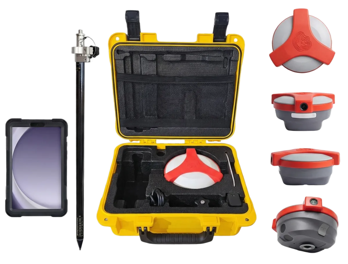
One Case. Everything You Need.
No more sourcing parts from multiple vendors. The TerraGenie Kit includes the receiver, tablet, pole, hard case, and all required accessories—so your crew is ready to work from day one.
No Training Needed
Built for Crews — Not Only Surveyors
Forget complex surveying software. TerraGenie is designed specifically for construction teams, with intuitive workflows that require little to no training. If your crew can read a plan, they can use TerraGenie.
The “Waze” for Construction
See exactly where you’re standing on the design—live. TerraGenie’s blue-dot navigation places your real-time position directly on your CAD plans. Overlay designs on Google Maps or orthophotos to instantly understand orientation and context on site.
Field-to-Office Sync
Everyone works from the same information. Points, measurements, and updated CAD files sync instantly to the cloud, so the office always sees what’s happening in the field—and crews never build from outdated plans.
Calculations on the Fly
Get answers while you’re still on site. Walk a stockpile perimeter for instant volume calculations, check ramp grades, and verify square footage for material orders—no waiting, no extra steps.
With 35 years of experience, our company always seeks technological innovation, and TerraGenie has proven to be the single most crucial tool I’ve introduced. Tasks that were previously outsourced are now performed by our in-house teams faster, easier, and more efficiently. The online flow of information from the field to the office is automatically processed, calculated, and displayed, significantly reducing delivery times and client billing. Beyond cost savings, TerraGenie ensures smooth and perfectly coordinated workflows between office and field.

My team and I have been using TerraGenie for over four years. The system gives us great independence and saves both time and money.


We have been using measurement devices for years, so adopting TerraGenie was a natural choice. They customized a marking and measurement system for us that we use daily across various sites, enabling continuous and accurate work through an easy-to-use interface and excellent GPS hardware. Our teams perform numerous field markings at every project stage, saving significant time and costs. TerraGenie’s support team is efficient and responsive, understanding the tight deadlines we work under. I highly recommend every construction, earthworks, and infrastructure company implement at least one such system.


What exactly does TerraGenie do?
TerraGenie puts professional layout and positioning directly in the hands of your field crews. It allows your foremen to see their exact location on the digital plans, mark points, check grades, and verify work in real-time; without waiting for a third-party surveyor.
Do I need a background in surveying to use this?
Absolutely not. We built TerraGenie specifically for construction superintendents and foremen, not surveyors. The interface is as simple as using a navigation app on your phone. If your crew can read a plan, they can use TerraGenie within 15 minutes of opening the box.
Will this replace my professional surveyor?
No, and it isn't meant to. TerraGenie is a productivity tool for internal construction layout and quality control. It eliminates the downtime of waiting on surveyors for daily tasks like grade checking or re-staking curb lines. However, you will still need a Professional Land Surveyor (PLS) for legal boundary establishment and final certifications.
How accurate is the system?
Extremely accurate. The TerraGenie G1 receiver uses 1408 channels to track every major satellite constellation (GPS, Glonass, Galileo, BeiDou). This delivers centimeter-level precision (typically 0.4 - 0.7 inches) horizontally and vertically, giving you the confidence to build right the first time.
Do I have to hold the pole perfectly straight to get a shot?
No. The G1 receiver features an advanced IMU Tilt Sensor that works at up to a 60-degree angle. You don’t need to stare at a bubble level. You can reach into a trench, lean over a fence, or hit a building corner with the pole tilted, and the system automatically calculates the correct point at the tip of the rod.
Does it work under trees or near tall buildings?
Yes. Because our receiver tracks all available satellite constellations (GPS, Glonass, Galileo, and BeiDou) simultaneously, it can maintain a "Fixed" solution in difficult environments like urban canyons or under heavy tree canopy where older systems often fail.
What happens if I lose cell service on the job site?
You keep working. While an internet connection is great for real-time office syncing, the hardware is built for the real world. The receiver has a powerful internal UHF radio that allows you to set up a local Base & Rover network, ensuring you have centimeter-level accuracy even in "dead zones" with zero cell coverage.
Is the equipment tough enough for my guys?
Yes. The entire kit is built to industrial standards. The tablet and receiver are rated IP67, meaning they are fully waterproof and dustproof. They are designed to withstand drops, vibration, mud, and rain; the typical conditions of an active job site.
What kind of files can I use?
We support the standard formats you already use. You can import DWG, DXF, and LandXML files directly. You can drag and drop files from your office computer, and they will sync instantly to the field tablet, overlaying your design right on the map.
Can the office see what the field is doing?
Yes, in real-time. TerraGenie features a cloud-based sync that connects the field and office. Engineers can push updated plans to the crew instantly (so no one builds off old prints), and the crew can send back as-built points and verification reports to the office immediately.
Does it support 3D surfaces and BIM?
Yes. The software handles 3D data structures, allowing you to check cuts/fills on a complex grading plan, verify pipe inverts, or stake out 3D BIM elements with ease.
How is TerraGenie sold?
We operate on a lease model designed to keep your upfront costs low. Instead of a massive $30,000 capital expense, you pay a small setup fee and a monthly subscription. This includes the hardware, the software license, the RTK network corrections, and full support; ensuring your equipment never becomes obsolete.
What kind of support do you offer?
We provide comprehensive support for construction teams. You get access to our US-based team for onboarding and training, plus direct engineering support for any technical questions. We know that downtime costs money, so we are here to keep you running.

DISCLAIMER: TerraGenie is a construction layout and estimation tool designed for contractor internal use. It is not intended to replace the services of a Professional Land Surveyor (PLS) for establishing property boundaries, certifying elevations for legal record, or submitting official survey data. Users are responsible for verifying construction tolerances.
© 2026 TerraGenie. All rights reserved.